Public Service
Rartian Bay Power Squadron offers Public Boating Courses to the public. Click here to learn more.
Learn about free Vessel Safety Check.
Cooperative Charting
 The USPS-NOS Cooperative Charting (CoOp) program is a joint effort between United States Power Squadrons ( a private non profit boating organization) and the National Ocean Service (NOS), a division of the National Oceanic and Atmospheric Agency (NOAA). The program is aimed at providing NOS with pertinent information about current conditions in waters charted by NOAA, especially those which are frequented by recreational boaters and, for which, NOAA is unable to provide their own hydrographic information because of budgetary constraints imposed by Congress in recent years.
More about USPS Cooperative Charting?
“Cooperative Charting” refers to an agreement between the United States Power Squadrons USPS and the United Oceanic Atmospheric Administration (NOAA). The agreement was first executed in 1963 and revised in January 1971 and again in 1983. The current agreement is “…to produce accurate and up to date nautical and aeronautical charts and related products and to preserve geodetic control stations in the National Geodetic Reference System (NGRS) through the use of well?trained volunteer observers.” NOAA was established in October of 1970 as part of the Department of Commerce. It is charged with providing weather forecasts, charting our coastal and estuarine waterways, producing aeronautical charts and supporting our marine fisheries industry. As part of these responsibilities, they produce and maintain over 970 nautical charts and 9 Coast Pilots for navigating our coastal waters and Great Lakes. The agency produces over 8,000 aeronautical charts and has installed and maintains over 750,000 geodetic control marks that provide the base geographic framework for mapping and charting, boundaries and property lines, and setting precise positions of space craft and satellites. Maintaining and upgrading this information against the changes made by nature and mankind is truly a monumental task. Changes occur so frequently that no amount of tax supported effort would be adequate to supply the corrections necessary to keep these documents current. As participants in the Cooperative Charting Program, USPS members observe these changes and submit corrections to NOAA, thereby saving the government (and tax payers) millions of dollars. In fact, Cooperative Charting has become the most effective user?participation program in all of the Federal services.
In April 2003 Co-Operative Charting took a giant leap forward by providing computer entry for all Chart corrections through internet access to the NOS website. This allows volunteers to add data to the system directly and not cause a delays and additional cost to NOS through the processes of transcribing data by hand from written forms to the NOS database. There are a number of new programs in the pipeline for the USPS and NOS partnership. These are Depth charting with the use of another computer program called Depth Wiz to correct the depths on charts and a new weather reporting program. This is an exciting activity and any interested member should contact the chairman of the Co-Op Charting Committee.
More information is available on the USPS website Co-Operative Charting page.
Raritan Boat Show
Members of the Raritan Bay Power Squadron working booth at the boat show.
.
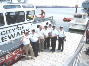
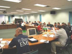
Raritan Bay Power Squadron training the Newark and Jersey City Police,
Fire and EMS first responders in the operation of the two new 50 foot $l.2 million combination patrol and fire boats.


